• Slideshow Start1

    The

    Pilots Atlas App!

  • Slideshow Start2

    ... Now available

    for iPad, iPhone and iPod ...

  • Slideshow Start3

    Atlas Eastern Hemisphere,
    USA, South-Canada/Mexico ...
    DESK Pad ...


Airport layer Waypoint layer
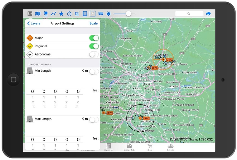
Airport layer - you can switch on/ off every single layer. In
the airport-layer you are able to select between Intl. Airports
(orange icon), regional airports (yellow icon) and airdromes
(white icon). Additional you can set "min runway length" and "max runway length" and you habe a button to switch on/off the labels for the airports, waypoints or Navaids.
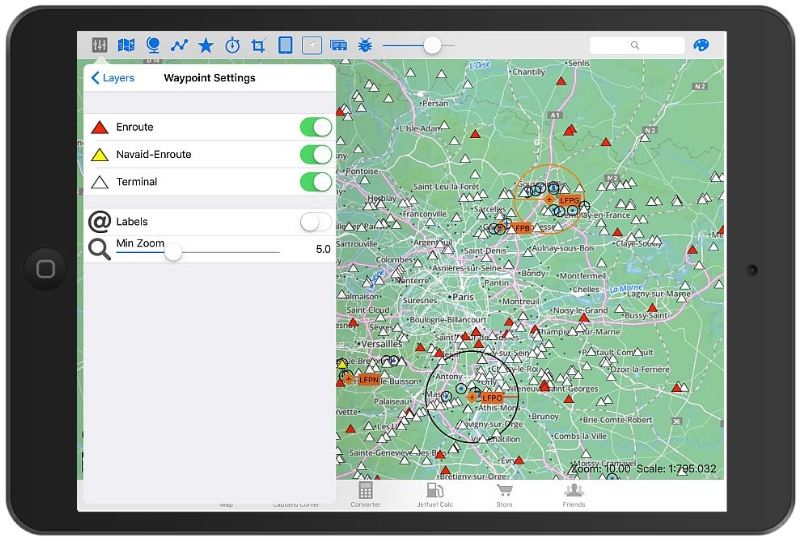
Waypoint layer - her you can additional select from which zoom-level the waypoints are showed in the map. The zoom-level and scale is shown in each screen downright.


waypoint layer with labels on  Navaid layer
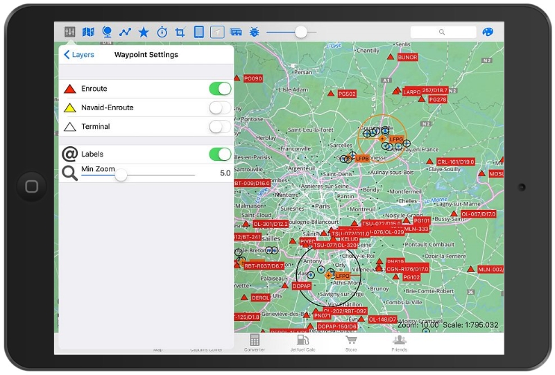
Waypoint layer with labels "on" - this is the waypoint layer
with labels "on" and zoom-level: 9+
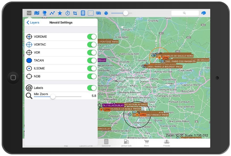
Navaid layer - with all navaids "on" and labels switched "on", visible from zoom level 7.5 or more.

Pilots Atlas App

Now available for iPad and iPhone.

Our famous Pilots “Free Flight” Atlas. Founded in 1998, is now available as an App for iPhone and iPad.

Detailed mapping with selectable aeronautical overlays.

Create your charts with the information you choose. Add private airports, waypoints, favorite locations, tips, notes, photos and ...

Continue reading >>

How to reach us

absoluteZero multimedia GmbH

Ginkgoring 26
63533 Mainhausen
Germany


ico tel  phone  +49 (0) 6182-84929660

ico email  E-Mail  contact

Wir nutzen für die bestmögliche Bereitstellung unserer Internetseite Cookies. Sie können die Verwendung von Cookies im Browser in den Einstellungen deaktivieren. Wenn Sie weiter surfen, ohne Ihre Einstellungen zu ändern, gehen wir davon aus, dass Sie mit der Verwendung von Cookies einverstanden sind.